*Make sure that you can explain how these landforms are formed using as many key words as possible*
These are all formed in the middle and lower course of the river due to the fact that deposition is the main geomorphic process needed to create these landforms.
These are all formed in the middle and lower course of the river due to the fact that deposition is the main geomorphic process needed to create these landforms.
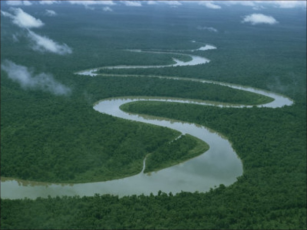
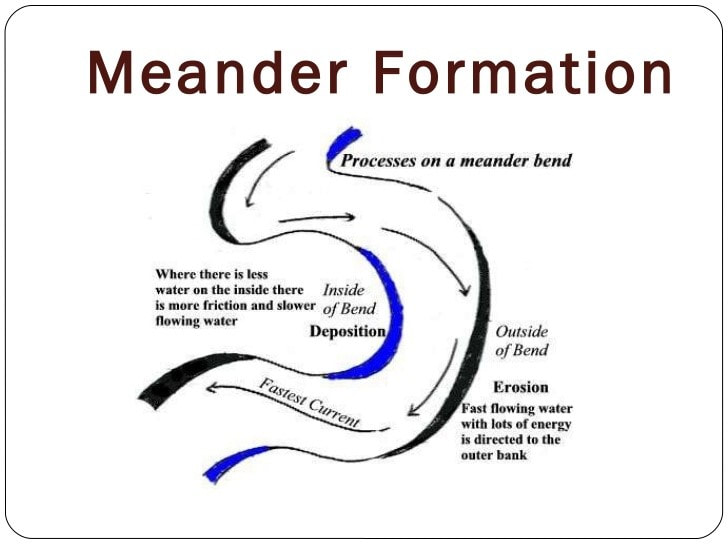
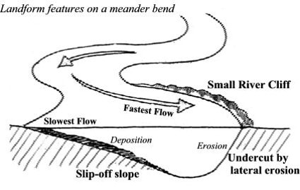
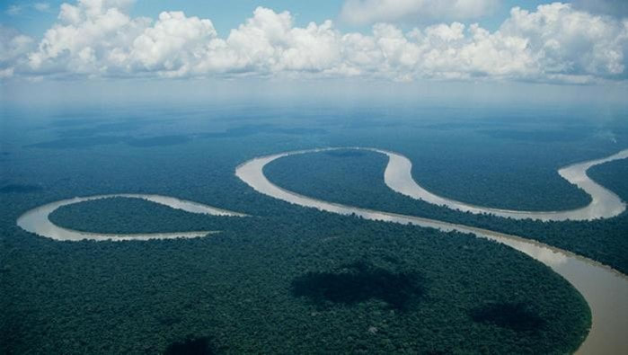
Meanders
|
|
|
1.The river travels over the band of soft rock, avoiding the hard rock
2.The flow of a river is faster on the outside of a meander which makes the river bend even more.
2.The flow of a river is faster on the outside of a meander which makes the river bend even more.
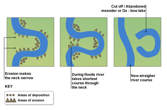
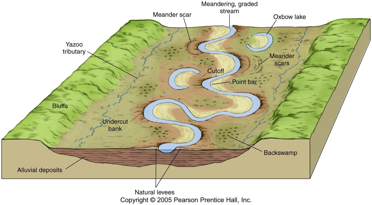
Oxbow lakes
3. So the water is tries to erode through the bend
4. Eventually, it will actually cut through
5. The flow of the river will take the path of least resistance and will flow through the straight line
6. So any water pushed into the old meander is going very slowly. That means it’ll drop any material it’s carrying as there’s no energy. This will eventually build up and dam off the old meander.
7. This leaves a horseshoe shaped lake called an oxbow lake
|
|
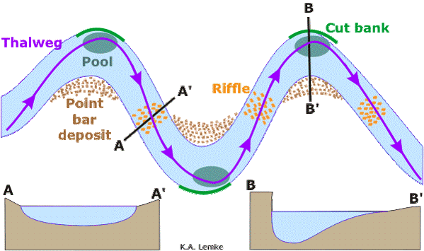
Pools and Riffles
|
Pools and riffles are parts of a meander.
Pools are the deepest and fastest flowing parts of a meander. Riffles are shallow and slower flowing parts of the meander. |
|
Floodplains
|
Floodplains are the areas of land that rivers flood onto when they exceed bankfull discharge.
Floodplains are created by the constant movement of meanders. They make great farmland because of alluvial deposits. Alluvium: Mineral rich load that is deposited on floodplains in times of flood. Alluvium is essential to keep farmland fertile. |
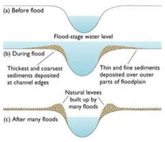
Natural Embankments / Levees
|
Natural levees are made as a result of floods. The river bursts its banks and deposits sediments at the channel edges which build up to make little walls on either side of the river bank.
|
|
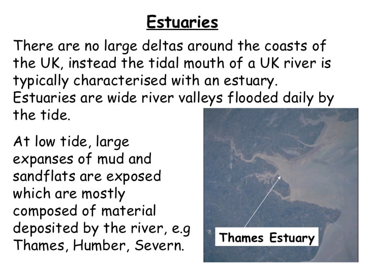
Estuary
This video explains how an estuary is formed.
|
|
