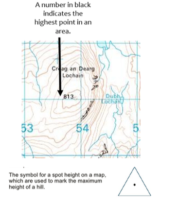
There are two ways that height is expressed on OS maps; contour lines and spot heights.
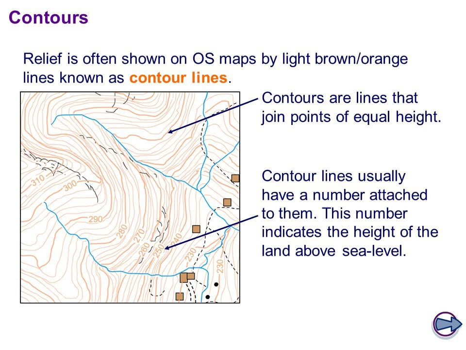
Contours
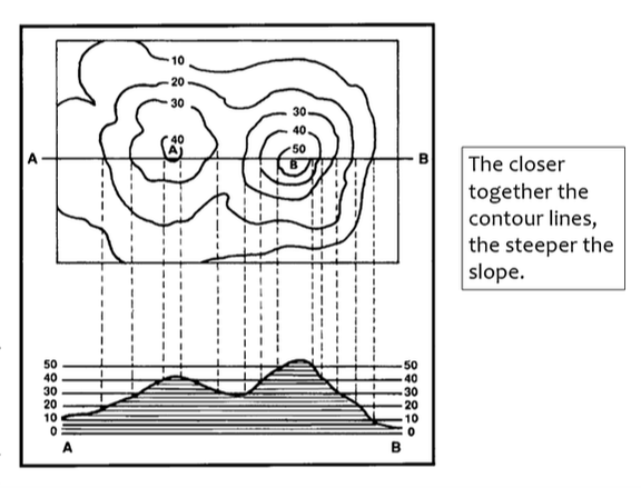
Contours join up areas of equal height and therefore show the height of the land. However, they also show the shape of the land (relief). The closer they are to each other, the steeper the land.
|
|
Spot Heights